
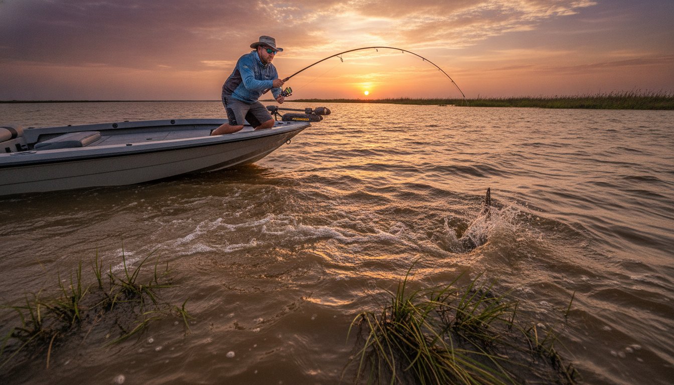
Fishing the Tides in Vermilion Bay: A Captain’s Guide to Success

Fishing the Tides in Vermilion Bay: A Captain’s Guide to Success

You can have the most expensive lure in the shop, but if the water isn’t moving, the fish simply aren’t biting. It’s a hard truth that every seasoned angler eventually learns the hard way. There is nothing more frustrating than wasting a whole Saturday casting into dead water while the sun beats down on a quiet marsh. Mastering the art of fishing the tides in Vermilion Bay is the only way to stop guessing and start catching. Most folks get confused by how the Atchafalaya River messes with local currents or, worse, they find themselves high and dry on a mud flat when the tide drops out. We’ve all been there, but it doesn’t have to be your story.

You’re about to learn the Cajun way of reading the marsh so you can predict exactly where Redfish and Speckled Trout are schooling. This guide breaks down how to time your runs to the weirs of Marsh Island and the oyster reefs near Cypremort Point. We’ll show you how to use the tide chart to hit your limit and navigate the complex waters of East Cote Blanche Bay like a seasoned pro. It’s time to turn those confusing tidal movements into your greatest advantage on the water.

Key Takeaways

  • Discover how the unique “bowl” geography of the region traps water and creates specialized feeding zones for hungry Speckled Trout.
  • Identify the critical role of Southwest Pass as the primary highway for fish entering the bay from the Gulf.
  • Master fishing the tides in vermilion bay by learning to predict how winter winds and summer heat shift fish behavior.
  • Learn the exact “match the hatch” tactics for tidal drains near Marsh Island to ensure you hit your limit of Redfish.
  • Find out why a specialized inshore boat and local expertise are the keys to safely navigating the shallowest mud flats during a falling tide.

Understanding Vermilion Bay Tides: More Than Just High and Low

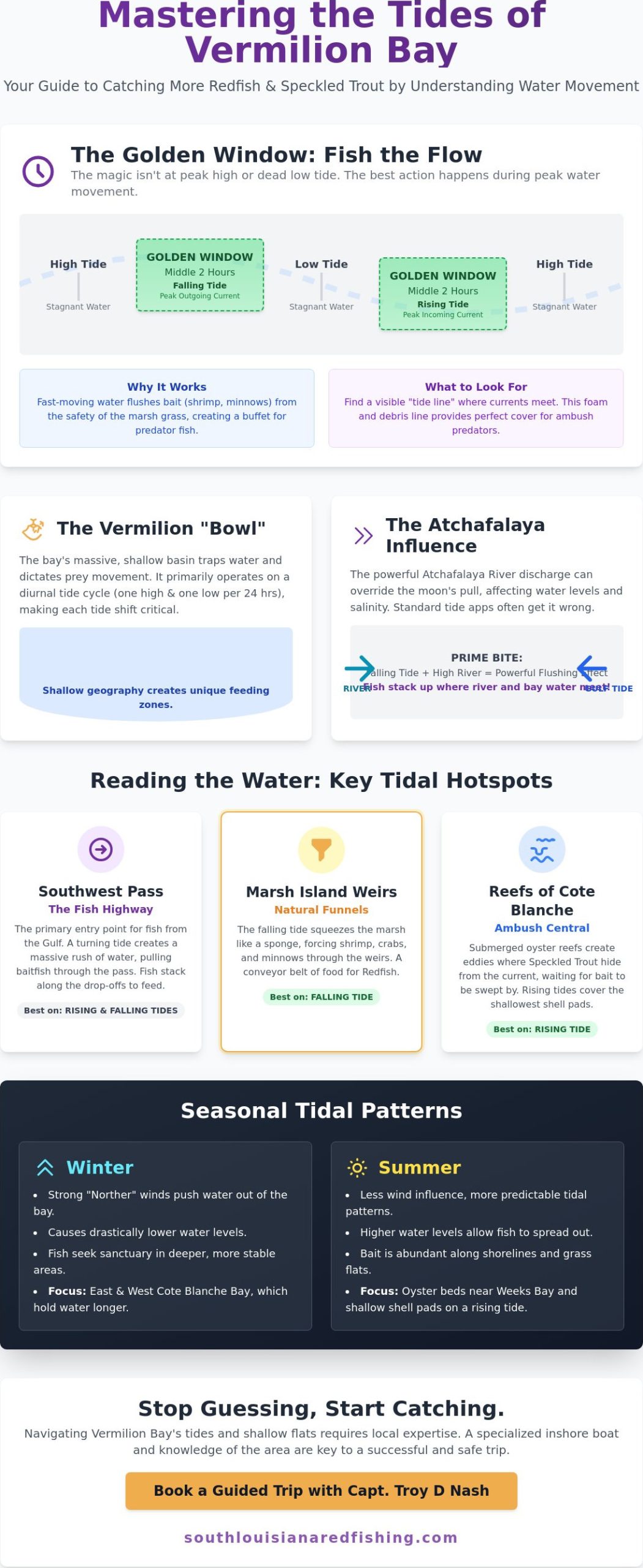
Success in these waters starts with a basic realization: the tide isn’t just about how deep the water is. In the shallow estuary of Vermilion Bay, the geography acts like a massive, shallow basin. This “bowl” shape traps water and dictates exactly how prey moves through the system. Unlike the Atlantic coast which often sees semi-diurnal tides, our corner of the Gulf primarily operates on a diurnal cycle. This means you usually get one big push and one big pull every twenty four hours. When you’re fishing the tides in vermilion bay, you have to make that single movement count. If the water is stagnant, the Redfish and Trout go into a lockjaw state. No movement means no dinner bell for the predators we’re after.

The “Moving Water” Rule

Don’t get obsessed with the peak high or the dead low. The real magic happens during the middle two hours of the change. This is the golden window where current velocity peaks and the marsh truly comes alive. Fast moving water forces shrimp and cocahoe minnows out of the safety of the grass and into the open. Predators wait at the mouth of drains and along the points of Cypremort Point to intercept them. A tide line is the visible boundary where two different water masses or currents meet, often collecting foam and debris that provide perfect cover for ambush predators. If you find a hard tide line near a reef, get your bait in there immediately.

The Atchafalaya Influence

Most generic tide apps fail because they don’t account for the Atchafalaya River. When river stages at Simmesport climb, a massive volume of fresh water pushes into the bay and can override the moon’s pull. This discharge can keep water levels high even during a predicted falling tide, which can be dangerous if you’re navigating shallow mud flats. It also drops the salinity, which shifts where the schools congregate. However, a falling tide combined with high river stages creates a powerful flushing effect. This is prime time for targeting various louisiana fish like Bull Reds and big Trout. They stack up exactly where the murky river water meets the cleaner bay water, waiting for the current to deliver a meal. Mastering this river effect is what separates the weekend warriors from the successful captains.

Reading the Water: Where the Tides Move the Fish

To truly master fishing the tides in vermilion bay, you have to think like a predator. While the bay itself is a massive basin, Southwest Pass serves as the primary highway for every Speckled Trout and Redfish entering from the Gulf. This deep water canyon is the lifeblood of the entire system. When the tide turns, it creates a massive rush of water that pulls baitfish through the pass and into the waiting mouths of schools stacked along the drop-offs. It’s high-speed action that requires a captain who knows exactly how to position a boat in the heavy current without spooking the school.

On a rising tide, your focus should shift toward the oyster beds near Weeks Bay and the shallow shell pads of Cypremort Point. These areas come alive as the saltier Gulf water pushes inland, bringing clarity and life to the shoreline. However, when the wind shifts to a “norther” in the winter, the water levels can drop drastically. During these times, East and West Cote Blanche Bay often hold water longer than the main bay. This provides a sanctuary for fish and a golden opportunity for anglers who don’t want to get stuck in the mud while the rest of the bay is draining out.

Fishing the Marsh Island Weirs

The weirs along the State Wildlife Refuge at Marsh Island are legendary for a reason. As the tide falls, the marsh acts like a giant sponge being squeezed. This drainage effect pulls shrimp, crabs, and glass minnows through the weirs, creating a natural funnel. You want to position your boat just off the current rip, casting back into the moving water. This is the ultimate setup for targeting hungry louisiana redfish as they sit on that conveyor belt of food. If you’re ready to experience this high-energy bite firsthand, booking a guided trip is the fastest way to learn these secret spots without the trial and error.

The Reefs of Cote Blanche

Submerged reefs in the Cote Blanche bays are ambush central. The uneven bottom creates eddies where Trout hide from the main current while waiting for bait to be swept past. Rising tides are generally superior here because they cover the shallowest shell pads, allowing you to drift over areas that are inaccessible at low tide. Always keep a close eye on your depth finder. Navigating these shallow flats during a negative low tide is a recipe for a long day on a sandbar if you aren’t careful. Stick to the known channels and watch the water color to stay in the safe zones where the big fish play.

Seasonal Tidal Patterns: Winter Lows vs. Summer Floods

A generic tide app might tell you one thing, but a 20-knot North wind will tell you another. In our region, wind direction often dictates the actual water level more than the lunar cycle. State officials have spent years Understanding Vermilion Bay’s Tidal Fluctuations to protect our coastline, and as an angler, you must do the same. Seasonal shifts change the entire playing field for fishing the tides in vermilion bay. You can’t fish the same spots in January that you hit in July and expect to see the same results. Success requires adjusting your strategy to match the seasonal “push and pull” of the Gulf.

Winter Northers and the “Mud Out”

Cold fronts are absolute game changers in the bay. When a strong North wind hits, it literally pushes the water out of the marsh and into the open Gulf. The flats around Cypremort Point and Weeks Bay can go bone dry in a matter of hours. When this happens, the fish don’t just vanish. They retreat to the deepest holes in the canals and the protected bends of the Intracoastal Waterway. This “mud out” is actually a blessing for the observant angler. When the water is gone, the bay’s hidden structure, like oyster lumps and deep washouts, is revealed for the first time. Use this time to scout and mark the spots that will hold fish when the water returns.

Summer Highs and Grass Beds

Summer brings the opposite challenge. The “Summer Doldrums” often feature slow tidal movement and soaring water temperatures that can make the bite sluggish. High summer tides allow Redfish to penetrate deep into the marsh grass of Marsh Island where they’re incredibly hard to reach. You’ll often see them tailing in the shallows of East Cote Blanche Bay during these extreme high water events. To beat the Louisiana heat, focus your efforts on the early morning incoming tide. This brings cooler, oxygen-rich water into the bay, triggering an aggressive feeding window before the midday sun shuts everything down. If the tide isn’t moving by noon, it’s time to head in for some Cajun food in Lafayette and wait for the evening shift.

As we transition into the fall, the Bull Red run begins. These massive fish follow specific tidal shifts into the deeper passes. This is the peak of the season, where the right tide can lead to a limit of fish in record time. This is where the decades of experience from a guide like Capt. Troy D Nash come into play. He knows when to ignore the digital chart and trust the feel of the wind and the smell of the marsh.
Fishing the Tides in Vermilion Bay: A Captain’s Guide to Success

Tactical Gear and Bait for Tidal Fishing

Moving water is your best friend, but it’s also your biggest challenge. When fishing the tides in vermilion bay, your tackle box needs to be as dynamic as the current. You can’t just throw the same lure all day and expect the same results as the water speed fluctuates. Success comes from understanding how to present your bait so it looks like a natural, struggling meal being swept along the marsh edges. If your lure isn’t reaching the right depth or moving at the right speed, the fish will ignore it every time.

Lures for Moving Water

In the heavy currents of Southwest Pass, you’ll need to beef up your presentation. A 1/2 oz or even 3/4 oz jig head is often necessary to get your plastic down to the strike zone where the big Trout are holding. Conversely, when you’re working the shallow drains of Marsh Island on a falling tide, a lighter 1/4 oz jig allows for a more natural flutter that mimics a dying shrimp. For the tea-colored water typical of a falling marsh tide, reach for darker plastics with plenty of flake or high-visibility chartreuse tails. A classic gold spoon is the go-to for red fish fishing louisiana style because it creates the flash and vibration needed to trigger a strike in murky conditions.

Popping corks are another essential tool in your arsenal. They keep your bait suspended at a specific depth, preventing it from getting snagged on oyster shells while the current carries it over the reef. The loud clack of the cork mimics the sound of a shrimp popping on the surface. This draws predators in from a distance, even when visibility is low. It’s a simple but deadly effective way to use the tide to your advantage.

Live Bait Strategies

When the tide is pushing hard, live bait requires a delicate touch. If you’re using live shrimp in a fast-moving rip, hook them through the horn or the tail. This ensures they swim naturally against the flow rather than spinning uncontrollably. For Redfish patrolling the shorelines of Cypremort Point, finger mullet are nearly unbeatable during a strong incoming tide. These hardy baitfish can handle the turbulence and stay active much longer than shrimp.

Holding your position is just as important as your bait choice. Whether you use a traditional anchor or a Power-Pole, staying stationary allows you to fan-cast a specific rip or eddy until you find the school. Don’t let the current push you past the fish. If you’re ready to see these tactics in action, book one of our guided fishing trips today and let a pro show you how to work the tides like a master.

Master the Bay with Capt. Troy D Nash

A tide app can give you numbers, but it can’t give you twenty five years of time on the water. Capt. Troy D Nash is a third generation guide who has spent his life fishing the tides in vermilion bay. He reads the subtle ripples on the surface and the scent of the marsh to find where the schools are hiding. When the digital charts say one thing and the Atchafalaya River says another, that heritage of local knowledge makes the difference between a long boat ride and a heavy cooler. We provide a complete, no-hassle adventure. We bring the top-tier gear, the local secret spots, and a specialized inshore boat designed to skim across the shallowest mud flats where the big Reds live. You just show up ready for the thrill of the strike.

The Cypremort Point Advantage

Choosing Cypremort Point as your home base means you spend less time traveling and more time casting. We are minutes away from the premier reefs and the legendary weirs of Marsh Island. Compare this to the high costs and grueling travel distances of deep sea or offshore fishing. While those trips often involve battling rough sea conditions and long runs to reach the fish, our inshore charters offer a high-action, family-friendly alternative. You get world-class results without the adverse conditions or seasonal closures often found in the open Gulf. It’s a focused, efficient way to experience the best of the Louisiana coast. We keep you in the “bite zone” longer, ensuring your time on the water is spent catching, not just riding.

Cajun Hospitality in Lafayette

Your adventure doesn’t have to end at the boat dock. Many of our guests choose to stay at Cypremort Point State Park to stay close to the action and enjoy the coastal scenery. You can easily pair your fishing trip with the incredible food and lafayette things to do louisiana. From authentic boudin to live Zydeco music, the local culture is just as vibrant as the fishing. This region is the heart of Cajun country, offering a total experience you won’t find anywhere else. Whether you’re a seasoned pro looking for a personal best or bringing the kids for their first big catch, we ensure every detail is handled with professional care. Ready to hammer the reds? Book your Vermilion Bay charter today! and let’s get out on the water.

Claim Your Limit on the Next Tide

Mastering water movement is the ultimate secret to consistent success on the coast. You now have the blueprint for identifying high-traffic highways like Southwest Pass and the natural conveyor belts created by the Marsh Island weirs. Whether you are navigating a winter “mud out” or chasing summer Redfish deep in the marsh grass, the key is staying adaptable. Understanding the unique bowl geography of the region ensures you never waste another minute fishing dead water.

Don’t leave your success to a generic digital chart that can’t feel the wind or smell the marsh. When you are fishing the tides in vermilion bay, there is no substitute for a 3rd Generation Local Guide with decades of professional tenure. Capt. Troy D Nash brings specialized inshore expertise that turns a simple boat ride into a masterclass in Cajun angling. We provide the gear, the knowledge, and the specialized boat to get you into the tightest spots where the big fish hide.

Book Your Vermilion Bay Adventure with Capt. Troy D Nash

The marsh is calling, and the tide is finally starting to move. Grab your hat and get ready for a world-class experience right here in South Louisiana!

Frequently Asked Questions

What is the best tide for redfish in Vermilion Bay?

A falling tide is the absolute best for targeting Redfish in our marsh. As the water level drops, it forces the Reds out of the safety of the thick grass and into the deeper drains and oyster-lined bayous. This movement creates a concentrated feeding zone. You can sit right at the mouth of a marsh drain and catch them hammering bait as it gets sucked out of the flats.

How does the Atchafalaya River affect the tides at Cypremort Point?

High river stages can effectively trap water in the bay, preventing a predicted low tide from actually dropping. This river push also lowers salinity levels, which often moves the schools toward the saltier water found near Southwest Pass. Successful anglers always check the river gauges at Simmesport because a massive freshwater surge can completely override the moon’s influence on the local current and water clarity.

Can I fish Vermilion Bay on a “dead” tide with no movement?

You can certainly fish during a dead tide, but you’ll need to change your tactics to find success. Without current to move the bait, fish tend to scatter rather than stack up in predictable ambush spots. Focus your efforts on deeper structure or nearshore oil rigs where a slight current might still exist. It’s the most challenging time for fishing the tides in vermilion bay, so be prepared to work much harder.

Is an incoming or outgoing tide better for speckled trout?

An incoming tide is generally superior for Speckled Trout because it brings in clearer, saltier water from the Gulf. Trout are sight predators and prefer the cleaner water that pushes past the reefs of Cypremort Point during the rising cycle. This influx of high-salinity water often triggers an aggressive feeding frenzy as the schools follow the clean water line inland toward the interior oyster beds and shallow shell pads.

What happens to the tide during a strong North wind?

A strong North wind acts like a giant broom that sweeps the water right out of the bay. This can cause a negative tide where water levels drop much lower than any chart predicts. While it makes navigation tricky, it also reveals the hidden bottom structure of the bay. Many local pros use these extreme lows to scout new oyster lumps and washouts that are usually hidden under several feet of water.

Where are the best tidal “funnels” for fishing near Marsh Island?

The man-made weirs along the shoreline of Marsh Island are the premier tidal funnels in the region. These structures create high-velocity current rips that act like a dinner bell for every predator in the area. Additionally, the deep-water canyon of Southwest Pass serves as a massive natural funnel, directing the entire volume of the bay’s tidal exchange through one narrow opening, creating a world-class ambush point for Bull Reds.

Do I need a special boat to fish the tides in the shallow bay?

A specialized inshore bay boat with a shallow draft is essential for safely navigating our waters. The bay is notoriously shallow, and a falling tide can quickly leave a heavy boat stranded on a mud flat. Our professional charters use boats specifically designed to skim across six inches of water while still being stable enough to handle the bay chop. This versatility allows us to reach the fish regardless of the tide.

How far in advance should I check the tide charts before booking a charter?

You should start looking at tide charts a few weeks out, but don’t finalize your game plan until 48 hours before your trip. Local weather and river discharge levels can shift the actual tide significantly from the predicted chart. When you book with a seasoned pro, we handle all this monitoring for fishing the tides in vermilion bay. We track wind and river trends daily to ensure you hit the moving water window.
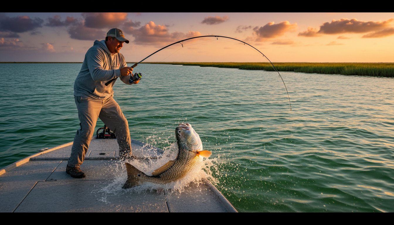
Vermilion Bay Tide Chart Fishing: The Ultimate Guide to Timing Your Epic Catch

Vermilion Bay Tide Chart Fishing: The Ultimate Guide to Timing Your Epic Catch

Last Friday, local angler Mike discovered that three inches of moving water at a Marsh Island weir is worth more than a full day of casting into a stagnant bayou. It’s a frustrating reality many face when they hit the water without a clear plan. You know the exhausting feeling of watching your bait sit motionless while the sun beats down on “dead” water. It’s the ultimate buzzkill for any trip. Mastering vermilion bay tide chart fishing is the absolute key to ensuring you don’t end up stuck on a mudflat while the Bull Reds are feeding elsewhere.

I’ve spent over 25 years as a 3rd generation guide learning these local rhythms, and I’m here to help you turn that data into an epic adventure. You’ll learn exactly how to predict the peak bite windows across Cypremort Point and the reefs of West Cote Blanche Bay. We’re diving into the specific tidal movements that trigger aggressive strikes so you can maximize every single minute on the water. From reading the weirs to timing the flats, he’s got you covered for your next legendary catch. Get ready to experience the thrill of a perfectly timed trip.

Key Takeaways

  • Master the unique diurnal cycle of Southwest Pass to understand how one high and one low tide per day dictates your success with vermilion bay tide chart fishing.
  • Learn to time the “Dinner Bell” effect by targeting marsh drains and bayou mouths as falling tides dislodge baitfish for hungry Reds and Trout.
  • Discover how South Louisiana winds can “stack” or “drain” the shallow bay, creating “wind tides” that are often more critical than the moon phase.
  • Pinpoint the best tidal windows to fish the “waterfall” effect at Marsh Island weirs and the deep-water superhighway of Southwest Pass.
  • Find out why a 3rd generation guide’s mental logs of water color and pressure offer a massive advantage over standard tide apps for your next epic adventure.

Decoding the Vermilion Bay Tide Chart for Fishing Success

Experience the thrill of a screaming reel in the heart of the Louisiana marsh. To limit out on speckled trout or giant bull reds, you have to master the vermilion bay tide chart fishing data before you ever launch the boat. Most beginners look at a chart and only see high or low numbers. Expert guides with 25 years of experience know better. A tide chart represents the vertical rise and fall of water levels. However, the horizontal flow, or current, is what actually triggers a feeding frenzy. Understanding what causes tides through lunar gravitational pulls is the first step in predicting where those fish will stack up against the grass lines. Your epic adventure begins when you learn to hunt the current, not just the clock.

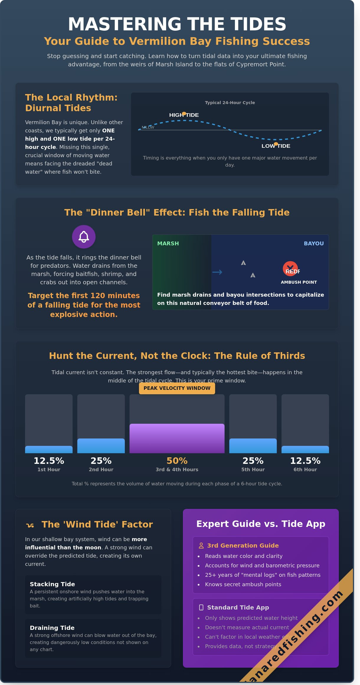
Vermilion Bay and the Southwest Pass operate on a unique diurnal tide cycle. This means the area typically sees one high and one low tide every 24 hours. This differs from the semi-diurnal cycles found in other areas like the Atlantic coast or even parts of the Florida Panhandle. Because you only get one major move per day, timing is everything. If you miss the window of moving water, you’re looking at “Dead Water.” Slack tide is the enemy of the inshore angler. When the current stops, baitfish stop moving, and predators like flounder and redfish hunker down. You want to be on your favorite oyster reef or weir when the water is pushing shrimp and mullet right into the strike zone.

To maximize your time on the water, use the rule of thirds. This rule states that in a typical tidal move, the current velocity isn’t consistent throughout the cycle. During the first hour of a move, about 12.5% of the water volume shifts. In the second hour, that jumps to 25%. By the middle two hours, 50% of the total volume of water is rushing through the passes. This is the peak velocity window where the bite usually turns on. Unlike the deep sea environments where current can be overwhelming, the 1.5 to 2.0 knots of flow in our bayous creates the perfect ambush scenario for trophy catches.

Reading Tide Heights: Mean Lower Low Water (MLLW)

The “zero” on your vermilion bay tide chart fishing app represents the Mean Lower Low Water. This is an average of the lowest daily tide recorded over a 19 year period. When you see a negative tide, such as -0.4 feet, you must use caution. In the shallow marsh ponds near Cypremort Point, a few inches of water is the difference between a successful day and a damaged prop. A 1.0 foot tide in our shallow bay is a massive volume of water, whereas in deep offshore canyons, it’s barely a ripple. Know your hull’s draft and watch the flats carefully.

Tidal Coefficients and Solunar Influence

The debate between Spring and Neap tides is constant among locals. During full and new moons, the gravitational pull is strongest, creating “Spring Tides” with 20% more range and faster currents. While more movement is usually better, too much can stir up silt in East Cote Blanche Bay, killing the water clarity. We use solunar major and minor periods to narrow the bite window even further. A major period lasting 120 minutes that aligns with a falling tide at a Marsh Island weir is a recipe for success. He’s got you covered with the local knowledge to pick the right moon phase for your trip.

How Tidal Movement Dictates Redfish and Trout Behavior

Successful angling in South Louisiana isn’t about luck; it’s about timing. When you’re working the marshes around Cypremort Point, mastering the vermilion bay tide chart fishing schedule is your ticket to success. Think of the tide as a dinner bell. As the water begins to move, it acts as a conveyor belt for the entire ecosystem. Moving water dislodges shrimp, cocahoes, and juvenile crabs from the safety of the thick marsh grass. This creates a feeding frenzy. Predators like Redfish and Speckled Trout know exactly where to wait for this easy meal. Understanding the science behind these shifts, such as the educational resources found at NOAA Tides & Currents, gives you the edge needed to predict exactly when the bite will turn on. While other areas like Venice offer different structures, our local bays rely heavily on these horizontal water movements to concentrate fish.

The Falling Tide: The Inshore Angler’s Best Friend

The first 120 minutes of a falling tide are often the most explosive for Bull Reds and heavy limits of keepers. As the water level drops, the marsh drains. This forces every living thing out of the shallow grass and into the deeper bayous. You want to position your boat at “ambush points” where canal intersections or marsh drains meet the main bayou flow.

  • The Strategy: Set your anchor or Power-Pole up-current from a drain. Cast your lure directly into the mouth of the run-out and let the current sweep it back naturally.
  • The Gear: 3.5-inch paddletails on a 1/4 oz jig head or a classic 1/2 oz gold spoon are legendary here. The vibration of a paddletail mimics a fleeing baitfish perfectly in the murky, moving water.
  • The Target: Focus on the swirling eddies created by the current hitting a point or a cluster of oysters.

The Rising Tide: Scouting the Flats

When the tide pushes back in, it brings life back to the shallows. This is the time to hunt the flats and oyster beds near South Marsh Island. Rising water allows Redfish to reach “virgin” grass beds that were high and dry just two hours prior. This provides an epic sight-fishing opportunity. Look for “crawling” reds with their backs or tails breaking the surface as they root for crabs in the newly flooded grass.

In the East and West Cote Blanche Bays, a rising tide often pushes in cleaner, high-salinity water from the Gulf. This clarity is vital for Speckled Trout, which prefer to hunt by sight. While Redfish stay tight to the grass, Speckled Trout usually hold in the slightly deeper water of the passes or over submerged reefs. They wait for the clean water to bring in schools of menhaden. Relying on a vermilion bay tide chart fishing plan ensures you’re in the right spot before the water gets too deep to spot the fish. If you want to see these patterns in action with a pro, you can always book an epic adventure to see how a veteran guide reads the water in real-time. Captains with 25 years of experience don’t just look at the clock; they look at the grass lines and the way the bait reacts to every inch of water movement.

The ‘Wind Tide’ Factor: Why the Chart Might Lie to You

Experience the thrill of a perfect morning on the water, but don’t let a standard vermilion bay tide chart fishing report be your only guide. Vermilion Bay is a unique beast. It functions like a massive, shallow bowl with an average depth of only 6 to 10 feet. Because the water is so thin, the wind often exerts more control over the water level than the moon’s gravitational pull. A seasoned guide knows that a “high tide” on paper can quickly become a “low tide” in reality if the wind isn’t cooperating.

South winds act like a giant plunger, shoving Gulf water through Southwest Pass and stacking it deep into East Cote Blanche Bay and Cypremort Point. This can create an artificial high tide that lasts for days. On the flip side, a strong North wind drains the bay like a pulled bathtub plug. During a winter “Norther,” you might see the muddy bottom of a canal that usually holds 4 feet of water. It’s a dramatic shift that catches many off-guard. A sustained 15mph North wind can negate a 1-foot lunar high tide.

Safety is the primary concern when these forces collide. When a stiff South wind pushes against a falling tide, it creates the “square wave” chop that Vermilion is famous for. This isn’t the rolling swell you find in other areas like Venice; it’s a tight, violent mess that can swamp a smaller bay boat. Your epic adventure depends on reading these conditions before you leave the dock at Cypremort Point State Park.

Calculating the ‘Real’ Water Level

Mastering the math of the marsh is essential for a successful day. You must combine the forecasted tide height with the wind’s speed and direction to find the “real” water level. If the chart predicts a 1.2-foot rise but a 20-knot North wind is howling, expect the water to actually drop. This creates dangerous trap scenarios. You might cruise into a back bayou near Burns Point on a rising lunar tide, only to find yourself high and dry two hours later because the wind shifted. The water can retreat 18 inches in a single afternoon, leaving you stuck until the wind dies down.

Strategic Adjustments for Wind-Driven Tides

When the wind picks up, your strategy must pivot immediately. Don’t fight the elements; use them. Look for leeward shorelines in Weeks Bay where the land provides a buffer against the gusts. These protected pockets often hold clearer water and calmer conditions. You can also use the wind to your advantage by fishing the windward banks of Marsh Island. A steady South wind pushes shrimp and menhaden directly against the grass lines, creating a buffet for predators. Understanding Redfish behavior helps you realize that these fish follow the bait regardless of what the lunar chart suggests. He’s got you covered if you know where the bait is stacking.

The biggest challenge with wind-driven tides is the “dirty” water factor. Strong winds churn up the soft, silty bottom of the bay, turning the water into something resembling chocolate milk. If your visibility drops below 6 inches, the bite will likely stall. Game fish like Speckled Trout and Redfish are sight hunters. You must hunt for “green” water, which is often found behind marsh weirs or inside protected coves where the grass filters out the sediment. Finding that pocket of clean water is often the difference between a slow day and limiting out on giants.

Vermilion Bay Tide Chart Fishing: The Ultimate Guide to Timing Your Epic Catch

Top Locations to Fish the Tide in South Louisiana

Southwest Pass serves as the primary superhighway for massive schools of Redfish and Speckled Trout moving between the Gulf and the Bay. With depths reaching over 100 feet in the center of the pass, the current here moves with incredible force. You’ll want to consult your vermilion bay tide chart fishing data to time the first two hours of a falling tide. This is when bait gets sucked out of the bay toward the Gulf, creating a concentrated feeding frenzy that is hard to beat. He’s got you covered if you want to see how the big fish handle that heavy moving water.

The Marsh Island Weirs offer a unique tactical advantage for those seeking heavy Black Drum and Reds. As the tide drops, water pours over these structures like a literal waterfall. This process oxygenates the water and traps baitfish against the structure. On a 1.5-foot tide drop, these weirs become high-activity zones. You can often see 30-inch bull reds stacked up in the turbulence; it’s an incredible sight for any angler. It’s a localized phenomenon that requires perfect timing to witness the peak action.

Reefs in the Cote Blanche area require a more nuanced approach. Submerged oyster bars act as speed bumps for the tide. The sweet spot is usually the down-current side where the depth changes from 4 feet to 8 feet rapidly. Positioning your boat to cast across these transitions ensures your lure mimics a disoriented shrimp or minnow. This is where 25 years of local experience really pays off for our clients. We know exactly which oyster mounds hold fish when the water starts to move.

Weeks Bay and the Avery Island canals provide a different challenge due to lower salinity levels. These areas are influenced by freshwater runoff, making them prime territory for Redfish that prefer brackish environments. When using your vermilion bay tide chart fishing tools, look for the incoming tide to push saltier water into these canals. This movement often triggers a bite from fish that have been lethargic during the slack period. It’s a tactical game of following the salt.

Fishing the Marsh Island Shoreline

Focus your efforts on the prominent points where the current wraps around the island’s edge. The southern shoreline features numerous gaps and cuts that act as natural drainage pipes for the interior marsh. During a falling tide, these spots produce epic Redfish encounters. It’s common to find schools of hungry fish waiting at the mouth of a single 4-foot wide cut. This is where the thrill of sight-fishing truly comes alive for our guests.

The Oil Rigs and Reefs of the Nearshore Gulf

Transitioning to the nearshore rigs offers a different rhythm. Unlike the long travel times and high fuel costs associated with Venice or other distant deep-sea destinations, these rigs are just a short run from Cypremort Point. During slack water, visibility around the pilings improves significantly. This is the best time to target Tripletail and Sheepshead. Inshore tides are far more critical for success here than the deep-water drifts found in offshore territories. Captain Troy knows exactly which rig is holding fish based on the day’s flow.

Ready to experience the best Redfish fishing in the United States? Book your next epic adventure with a veteran guide who knows these tides inside and out.

Why an Expert Guide Beats a Tide Chart Every Time

A digital app can tell you when the water is supposed to move, but it’s blind to the actual conditions on the ground. If you rely solely on a vermilion bay tide chart fishing app, you’ll miss the fact that a 15-knot south wind just pushed a wall of chocolate-colored water into your favorite marsh drain. Apps don’t see water clarity, and they certainly don’t feel the barometric pressure drops that trigger a feeding frenzy. Captain Troy Nash brings a 3rd generation advantage to every trip. With over 25 years of full-time guiding experience, he’s built a mental log that no software can replicate. He understands how the Redfish and Speckled Trout react when the sky turns gray or the wind shifts unexpectedly.

Climbing aboard our boat means you can leave the charts at home. We handle the complex math of tide offsets and moon phases so you don’t have to. Success in the marsh requires more than just knowing when the tide is high. It requires knowing which specific oyster beds or weirs will hold bait when that water starts to recede. While “other areas” like Venice might require grueling boat rides to find clear water, we use our local knowledge to find the bite right here in our backyard. We’ve spent decades learning the nuances of Weeks Bay and East Cote Blanche Bay, ensuring you’re always in the right spot at the right time.

The thrill of the hunt often requires a mid-trip pivot. If the tide stalls or the wind picks up, we don’t just sit there waiting for the numbers on a screen to change. We move. We might shift from the interior grass flats of Marsh Island to the deeper nearshore oil rigs or rock piles. This flexibility is what separates a frustrating day on the water from an epic adventure. We’re constantly reading the birds, the bait movement, and the water texture to stay one step ahead of the fish. You won’t find that kind of real-time analysis on any free download.

The Value of Local Experience at Cypremort Point

Navigating the waters around Cypremort Point requires more than a standard GPS. Shifting sandbars and submerged hazards can ruin a lower unit in seconds for the uninitiated. A veteran guide knows the “hidden” paths through the shallows that don’t appear on any digital map. Even on “dead” tide days with minimal water movement, 25 years of experience helps us find the “bite” in narrow canals where the current is compressed. You can experience the thrill of a worry-free day where your only job is to focus on the rod and the next big strike.

Ready for Your Epic Adventure?

Every South Louisiana Redfishing charter is a fully equipped experience. We provide the high-quality rods, reels, and tackle needed to land giant bull reds and hard-fighting Black Drum. We even supply the bait and ice. When you book, we don’t just pick a random start time. We analyze the specific vermilion bay tide chart fishing data for your date to recommend the optimal launch window for success. Whether you prefer fly, spin, or baitcast, he’s got you covered for a world-class day on the water.

Book Your Epic Vermilion Bay Adventure Today!

Claim Your Prize on the Vermilion Bay Flats

Mastering vermilion bay tide chart fishing requires more than just reading a graph. You’ve got to account for the South Louisiana wind that can push water into the marsh or drain it faster than any printed table predicts. Success hinges on knowing exactly how the 2 daily tidal cycles interact with the 5 major weirs at Marsh Island and the shallow oyster beds near Cypremort Point. While a chart provides a baseline, it can’t account for the real-time shifts that trigger a massive Redfish feeding frenzy.

Don’t leave your 2026 trip to chance. Captain Troy Nash is a 3rd generation veteran guide with over 25 years of local experience navigating these specific bayous and shorelines. He’s got you covered with all the tackle and licensing guidance needed for an epic day on the water. You’ll spend your time catching fish rather than making the 60 mile boat runs common in other areas like Venice. It’s time to trade the guesswork for a guaranteed adventure in the heart of South Louisiana.

Experience the Thrill-Book Your 2026 Vermilion Bay Charter!

The bull reds are waiting for the tide to turn. We’ll see you on the boat!

Frequently Asked Questions

What is the best tide for redfish in Vermilion Bay?

A falling tide is the absolute best for catching bull reds in the Vermilion Bay marshes. As the water drops, it pulls shrimp and baitfish out of the grass into the deeper bayous where reds wait to strike. Look for a 0.5 to 1.0 foot drop over a six hour window for the most aggressive feeding. This movement creates a conveyor belt of food that helps you limit out quickly on an epic adventure.

Does the tide matter for fishing near the oil rigs?

Yes, the tide is critical when fishing the closest oil rigs in West Cote Blanche Bay because it dictates how fish position around the structure. You want a steady current of at least 0.3 knots to push bait against the legs of the rig. When the water moves, speckled trout and sheepshead stack up on the upcurrent side. Without that flow, the fish scatter, making it harder to find a concentrated school.

How do I know if the water is too low to get my boat into Marsh Island?

You’ll know the water is too low if the tide gauge at Cypremort Point reads below 0.2 feet during a north wind. Navigating the weirs and shallow canals of Marsh Island requires at least 18 inches of clearance for most bay boats. If you see mud flats exposed near the shoreline, it’s a signal to stick to the deeper passes. Always check your vermilion bay tide chart fishing data before heading into the interior ponds.

Is a rising tide better than a falling tide for speckled trout?

A rising tide is generally superior for speckled trout because it brings cooler, saltier water from the Gulf into the bay. This influx of clean water often triggers a feeding frenzy near oyster beds and reefs. Aim for a 0.8 foot rise to see the best results. While a falling tide works, the incoming push is when you’ll find those giant specks roaming the flats for a real thrill.

What happens to the fishing if the tide doesn’t move at all?

Fishing usually grinds to a halt when there’s a slack tide with zero movement for more than 45 minutes. Without a current, predatory fish like flounder and redfish stop patrolling the shorelines. You might catch a few, but it’s nothing like the action during a 1.2 foot tidal swing. If the water is stagnant, try moving to deeper channels where even a slight subsurface flow might still exist to find the bite.

How much does the wind affect the tide chart in Cypremort Point?

A strong north wind over 15 mph can push water out of the bay, making the actual level 1 foot lower than predicted on your vermilion bay tide chart fishing app. Conversely, a steady south wind piles water into the marsh, creating higher levels than expected. This wind factor is why local expertise is vital. Unlike deeper areas like Venice, our shallow bays are highly sensitive to these 24 hour weather shifts.

Can you catch fish during a negative tide in South Louisiana?

You can catch massive fish during a negative tide by targeting the deep holes in major bayous like those near Weeks Bay. When the tide hits -0.5 feet, fish are forced out of the shallow grass and into concentrated pockets of water. This is a prime time to find bull reds and black drum stacked in 6 to 10 feet of water. It’s a high stakes way to fish that often leads to success.

Where is the best place to launch a boat to access Vermilion Bay tides?

The Cypremort Point State Park boat launch is the premier spot to access the best tides in the region. It features 4 paved ramps and puts you within a 15 minute run of the best reefs and Marsh Island weirs. Launching here saves you time and fuel compared to other launches. It’s the perfect starting point for your epic adventure in South Louisiana’s most productive inshore waters today.