What if the secret to a limit of Redfish isn’t just about the bait you’re throwing, but the exact minute the water starts moving through a Marsh Island cut? Many folks get frustrated staring at technical charts only to spend their day in “dead water” while the wind ruins their plans. If you’ve ever felt the sting of a wasted morning at the boat launch because the tide didn’t act right, you aren’t alone. Mastering these cycles is the difference between a quiet boat and a screaming reel, and these cypremort point fishing tips are designed to put the odds back in your favor.
I’ve spent decades learning the “pinch points” of Vermilion Bay, and I’m ready to help you use the 2026 tide charts like a pro. You’ll learn how to identify the exact window for peak fish activity, understand the power of falling tides, and see how the wind shifts the game around Cypremort Point State Park. Whether you’re chasing Speckled Trout near the reefs or planning a full day of Cajun adventure followed by a world-class meal in nearby Lafayette, this guide ensures your time on the water is productive. Let’s get you ready for a successful trip in the premier inshore destination of South Louisiana.
Key Takeaways
- Discover why “moving water” is the lifeblood of Vermilion Bay and how to time your trip when the tide flushes baitfish directly to hungry predators.
- Learn to navigate 2026 tide charts by focusing on the Cypremort Point and Marsh Island stations to find the exact water depth for the marsh flats.
- Master these essential cypremort point fishing tips to capitalize on the “Golden Hour” for Redfish during a falling tide.
- Compare the safety and cost-effectiveness of staying inshore in Vermilion Bay versus the long travel distances and rougher conditions of deep-sea trips.
- Gain the upper hand by combining technical data with the multi-generational expertise of Capt. Troy D Nash to find the bay’s secret “pinch points.”
Why Tide Charts Are Essential for South Louisiana Fishing
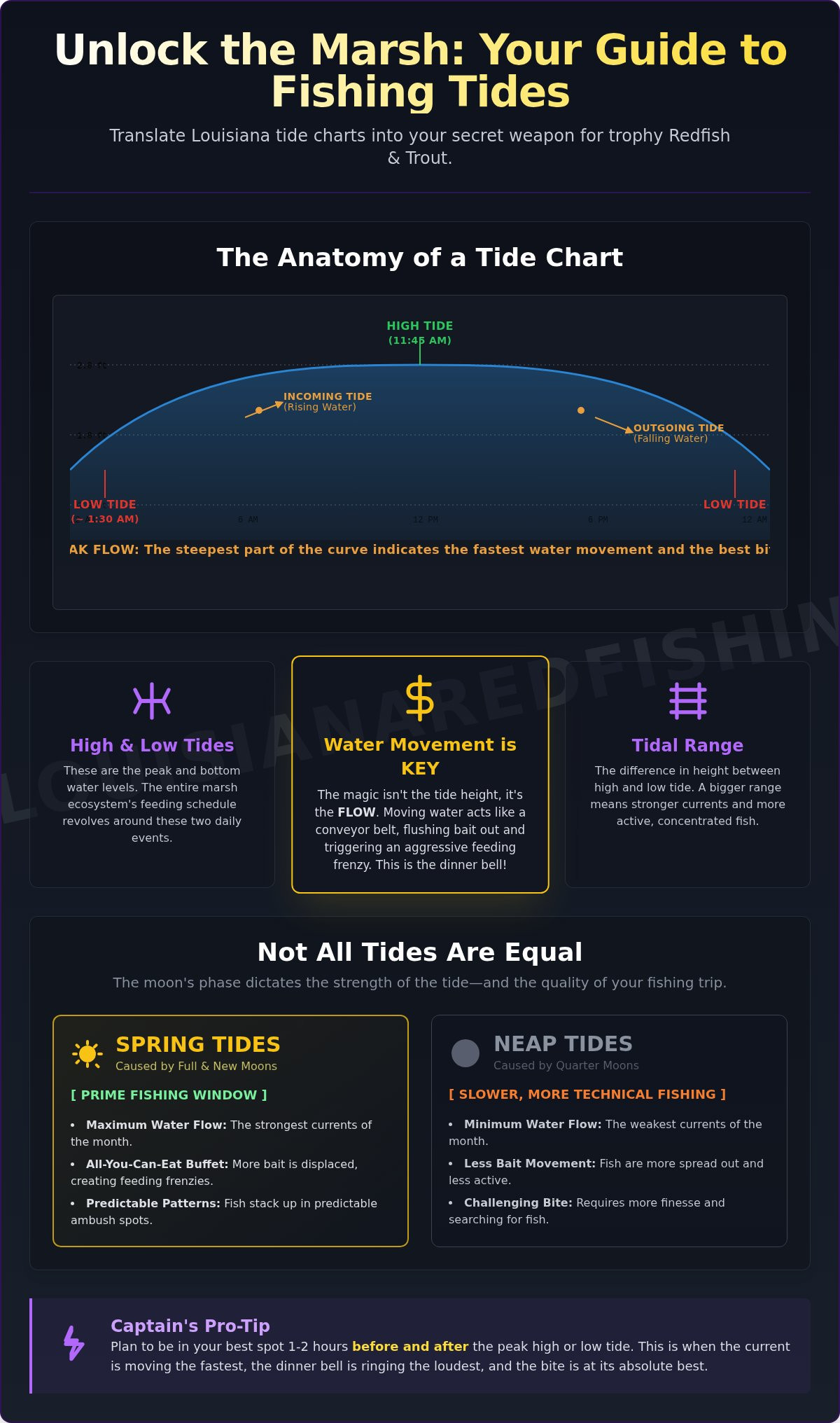
In the shallow marshes of South Louisiana, water movement isn’t just a detail; it’s the entire engine of the ecosystem. Understanding Why Tide Charts Are Essential is the first step toward a cooler full of fish. When the tide pulls, it acts like a giant vacuum. It sucks shrimp, crabs, and small baitfish out of the safety of the marsh grass and into the open bayous. This creates a predictable feeding frenzy. Predators like Redfish and Speckled Trout don’t want to work harder than they have to. They simply wait at the “dinner table” for the tide to deliver the meal. For those seeking the best cypremort point fishing tips, the lesson is simple: find the movement, find the fish.
Cypremort Point serves as the primary gateway for the entire Vermilion Bay system. Because the bay is relatively enclosed, the narrow passes around the Point and Marsh Island create “pinch points” where water velocity increases. If you’re fishing during a “dead tide,” which is a period with no vertical or horizontal movement, you’re likely wasting your time. Without current to disorient baitfish, predators become lethargic and move into deeper, cooler holes to wait for the next cycle. Mastering the clock is just as important as mastering your cast.
The Science of the Marsh: Bait and Predators
East and West Cote Blanche Bay are dynamic environments where the food chain is constantly in motion. During a falling tide, the water level drops in the surrounding lakes and canals, forcing millions of shrimp to migrate toward the Gulf. Redfish are experts at positioning themselves exactly where a small bayou empties into a larger body of water. They sit with their noses into the current, snapping up anything the tide washes their way. Meanwhile, Speckled Trout often congregate around submerged oyster beds. The uneven surface of the reef creates tidal turbulence and “dead zones” where trout can hover while watching for baitfish struggling against the flow. These natural ambush points are the heart of our local fishery.
Tidal Range vs. Tidal Flow
Anglers used to other areas might be surprised to learn that South Louisiana has a very small tidal range, often measuring less than two feet. Don’t let that small number fool you. Even a 6-inch change in water level can move a massive volume of water across the expansive flats of Vermilion Bay. Because the water is so shallow, that minor shift represents a significant percentage of the total water volume in the marsh. In 2026, the tidal coefficient will be your best friend; it’s a numerical value representing the moon’s gravitational pull where a higher number signals the aggressive water movement needed to trigger a Marsh Island feeding frenzy. These cypremort point fishing tips ensure you aren’t just looking at the height of the water, but the power behind its movement.
Reading 2026 Louisiana Tide Charts for Vermilion Bay Success
To get the most out of your trip, Reading 2026 Louisiana Tide Charts accurately is non-negotiable. Most anglers look at the high and low times and stop there. They miss the “Mean Lower Low Water” (MLLW) reference, which is the average height of the lowest tide recorded at a station. In our shallow marshes, a chart showing 0.0 feet doesn’t mean you’re out of water. It just means you’re at that baseline average. Understanding this helps you avoid grounding your boat in the flats of West Cote Blanche Bay when the water gets skinny.
Timing your cast requires understanding the “Rule of Twelfths.” This rule explains that the tide doesn’t move at a constant speed. It starts slowly, accelerates to its maximum velocity during the middle two hours of the cycle, and then slows down again. These middle hours are when the “pinch points” around Marsh Island become gold mines for activity. If you’re looking for the best cypremort point fishing tips, remember that the peak flow usually happens in the third and fourth hours of a six-hour cycle. When the water is screaming through a cut, the fish are almost always biting.
The South Louisiana Wind Factor
This is where many visitors get tripped up. A relentless South wind can “stack” water against the coastline, effectively cancelling out a predicted low tide. Conversely, a stiff North wind can “blow the water out” of the marsh. This leaves oyster beds high and dry even if the chart says there’s plenty of depth. Always check the wind direction before you launch from Cypremort Point State Park. If the wind and tide are moving in the same direction, expect an aggressive, fast-moving current that triggers a feeding frenzy. While charts provide the data, they don’t provide the intuition. For a truly master-class experience, consider booking a guided fishing trip to see how these environmental factors work together in real-time.
2026 Key Stations for the Vermilion Region
- Station 1: Cypremort Point. This is your primary anchor for the bay. It’s the most reliable data point for the main body of water and the immediate shorelines.
- Station 2: Marsh Island (South Pass). Essential for those targeting “Bull Reds” and nearshore species. The tide here is often 30 to 45 minutes ahead of the Point, giving you a head start on the action.
- Station 3: Weeks Bay. Use this station if you’re venturing into the protected canal systems or the northern reaches of the marsh. It’s much more shielded than the open waters near Burns Point.
Unlike the long, expensive hauls required for deep-sea fishing in other areas like Venice, our inshore runs are short and focused. These cypremort point fishing tips allow you to spend more time with a tight line and less time burning fuel. Combining tide data with solunar tables, which track moon rise and set times, will give you the ultimate peak feeding window for Redfish and Trout.
Inshore vs. Offshore: How Tides Impact Your Budget and Catch
Why spend four hours of your day traveling when you could be casting? In other areas like Venice, the run to the prime fishing grounds can feel like a marathon. In Vermilion Bay, we’re often on the fish in a fraction of that time. This is one of the most practical cypremort point fishing tips: choose a location that maximizes your line-in-the-water time. Because our trips focus on the protected marshes and flats, the massive Gulf swells that create “no-go” days for offshore boats rarely stop us. You get a smoother ride, a safer environment for the kids, and a significantly lower fuel bill compared to deep-sea ventures.
The beauty of the marsh is that you can catch louisiana redfish on virtually any tide if you have the local knowledge to find where the water is moving. Unlike deep-sea fishing, where you might be chasing a specific species with strict seasonal closures or federal poundage limits, our inshore fishery is a year-round powerhouse. We don’t have to worry about the 2026 red snapper allocation being met early. The fish are here, and they’re ready to eat.
Adverse Sea Conditions and Deep Sea Limits
Offshore trips are frequently at the mercy of the weather. If the wind kicks up to 15 knots, those big boats often stay at the dock to avoid dangerous conditions. In the Vermilion Bay region, we simply tuck into a different canal or find a leeward shoreline near Marsh Island. We aren’t limited by the same seasonal closures that plague the deep-sea industry. Redfish and Trout remain available regardless of the month. This reliability makes Cypremort Point the premier choice for families and casual anglers who want a guaranteed adventure without the risk of seasickness or a cancelled trip due to rough seas.
Maximizing Fishing Time
Think about the math of a standard charter. Would you rather spend seven hours actively fishing or four hours bouncing across open water? Our guided trips focus on total efficiency. By studying the Best Tide Patterns for Redfish, we can jump from a slack weir to a moving lake in minutes. Capt. Troy D Nash uses 30 years of experience to pivot based on real-time conditions. If the tide isn’t moving at the Point, he knows exactly which Marsh Island cut is starting to drain. These cypremort point fishing tips aren’t just about catching fish; they’re about respecting your time and your budget. We keep the boat moving until we find the action, ensuring every minute of your trip is spent chasing a new personal best.
Master the Marsh: Best Tide Patterns for Redfish and Trout
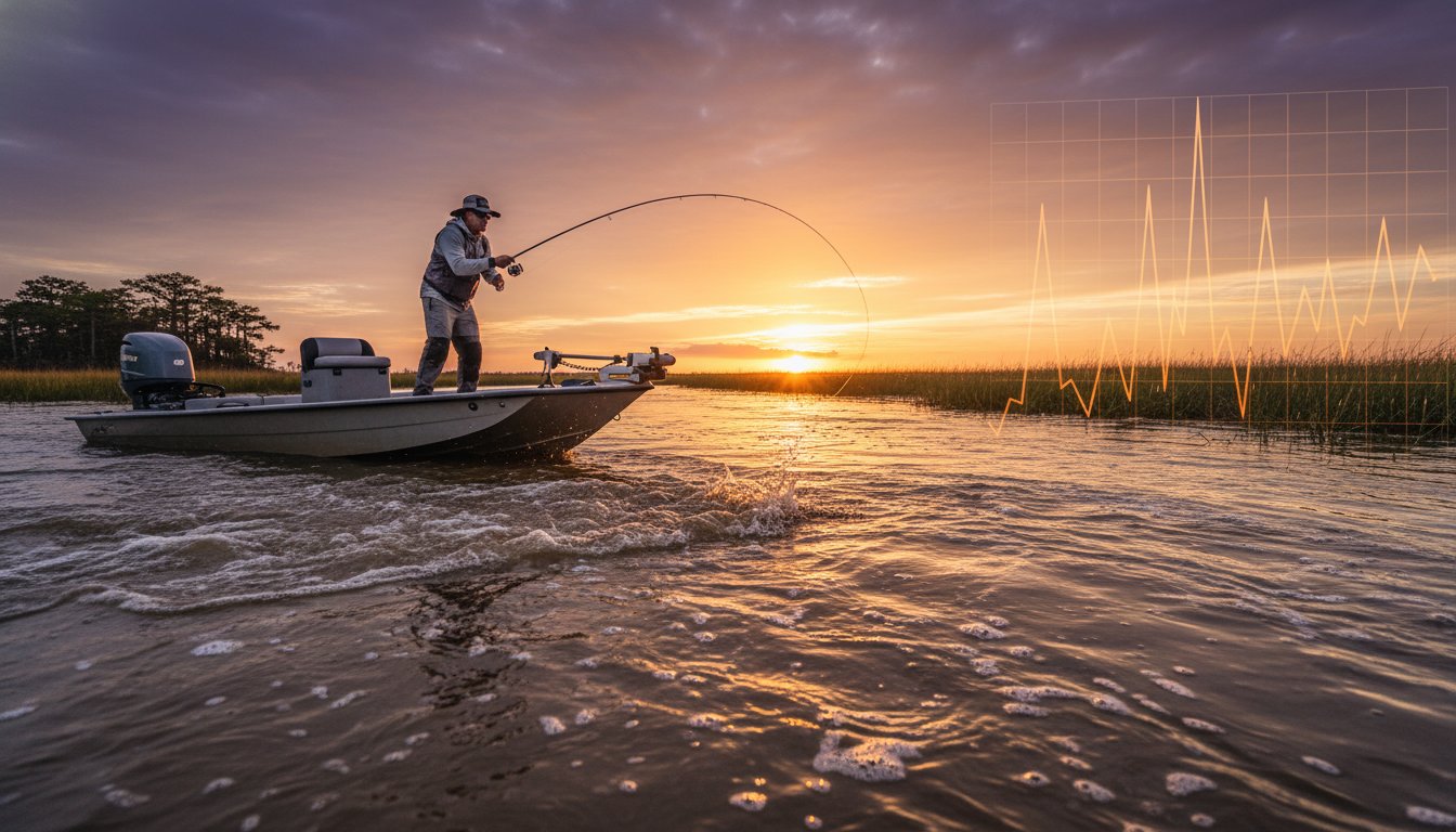
Timing your cast is the difference between a record-breaking day and an empty ice chest. In the Vermilion Bay region, the falling tide is the undisputed “Golden Hour” for Redfish. As the water level drops, it forces shrimp and crabs out of the safety of the marsh grass and into the open bayous. This movement creates a natural buffet at the mouth of every cut. This is the prime window for red fish fishing louisiana, as predators stack up to intercept the retreating bait. Conversely, a rising tide pushes clean, high-salinity water from the Gulf into the bay, which is exactly what Speckled Trout crave. They follow that clear water onto the oyster beds and reefs, ready to strike.
Even when the water stops moving during a slack tide, the action doesn’t have to end. While Redfish might turn sluggish, this is the perfect time to slow down your presentation. Target Black Drum or Flounder near deep-water structures where they hover regardless of current. For those looking for more variety, the nearshore oil rigs just outside the bay offer an incredible alternative. The tide hitting these massive steel legs creates powerful eddies that trap baitfish, attracting everything from Trout to Sheepshead. These cypremort point fishing tips ensure you have a game plan for every stage of the tidal cycle.
Targeting Redfish in the Shallows
When the tide starts to drop, keep your eyes peeled for “nervous water” along the shoreline. You’ll see tiny ripples or bait jumping in a panic, which usually indicates a Redfish is on the hunt nearby. In the Vermilion Bay system, weirs and drainage points are high-traffic areas. These spots act as funnels, concentrating the food supply into a small space. Positioning your boat just down-current of a weir allows you to present your bait naturally as it washes toward the predators. It’s an high-energy way to fish that rewards patience and sharp eyes. If you want to see these patterns in action, book your guided fishing trip with a pro who knows every secret cut around Marsh Island.
Speckled Trout and Nearshore Reefs
Speckled Trout are much more sensitive to water clarity than Redfish. They love the “green” water that comes in with a strong rising tide. Focus your efforts on the current seams created by the reefs in East and West Cote Blanche Bay. As the water hits these submerged oyster beds, it creates a break in the flow where Trout can hover without burning energy. Use your trolling motor to stay in the strike zone and cast up-current, allowing your bait to drift naturally over the reef. These cypremort point fishing tips are essential for staying on the school as they move with the rising water. The nearshore reefs are the premier destination for Trout enthusiasts looking for consistent, world-class action without the long haul to deep-sea grounds.
Beyond the Chart: Fishing Vermilion Bay with Capt. Troy D Nash
Technical data only gets you so far in the dynamic marshes of South Louisiana. While a mobile app can provide raw numbers, it cannot tell you how a shifting North wind is currently affecting the bait movement in a specific Marsh Island cut. That is where decades of time on the water become your greatest asset. For the most effective cypremort point fishing tips, you need a guide who has lived these cycles for generations. Capt. Troy D Nash doesn’t just follow a chart; he interprets a lifetime of patterns to ensure your group is always in the right place at the right time.
The 2026 season promises incredible opportunities for those who know how to time the moon phases. By booking your trip around the peak tidal coefficients, you maximize your chances of seeing the marsh at its most active. We focus on the unique “pinch points” of the Vermilion Bay system, where the current creates a natural funnel for Redfish and Trout. This level of precision is why our guided trips are framed as major life events rather than just a casual day on the water. We are dedicated to providing a high-energy, results-driven journey that leaves every angler with a story to tell.
A Legacy of Expertise at Cypremort Point
Capt. Troy brings over 30 years of professional tenure and a third-generation heritage to every charter. This deep-rooted expertise allows him to read the birds, the water color, and the subtle ripples of the tide with an accuracy that technology can’t match. It is a welcoming and reassuring experience for everyone on board, from seasoned pros to families with young kids. We take pride in our ability to master the technical aspects of the bay, ensuring that your only job is to enjoy the thrill of the strike. When you fish with a seasoned expert, you aren’t just guessing where the fish are; you’re leveraging decades of local knowledge to find them.
Plan Your Cajun Coast Adventure
The journey doesn’t end when we return to the dock at Cypremort Point State Park. Our location is the premier gateway to a full South Louisiana tourism experience. After a successful morning of landing giants in the marsh, you are perfectly positioned to explore the heart of Cajun country. Many of our guests enjoy the short drive to discover the many lafayette things to do louisiana, including world-class dining and cultural attractions. There is nothing quite like a day of world-class fishing followed by a meal of authentic gumbo or spicy boiled crawfish in nearby Lafayette.
Don’t leave your 2026 fishing success to chance or a confusing technical chart. Secure your spot on the boat during the most productive moon phases and tidal windows of the year. Book your South Louisiana fishing trip today! and let’s get you on the water for an adventure you’ll never forget.
Dominate the Marsh on Your Next Vermilion Bay Adventure
Mastering the 2026 tide charts is more than just reading numbers; it’s about predicting how moving water interacts with the reefs and marsh cuts of Marsh Island. You’ve learned that a falling tide is the golden window for Redfish and how the rising tide brings clean Gulf water for Speckled Trout. These cypremort point fishing tips are your foundation for a successful trip, but the real advantage comes from combining data with the intuition of a seasoned professional. Don’t let a “dead tide” or a stiff North wind ruin your day on the water.
When you’re ready to turn these insights into a cooler full of fish, lean on the expertise of a 3rd generation local guide. With decades of professional experience across Vermilion Bay and Cote Blanche Bay, Capt. Troy D Nash knows every secret “pinch point” the apps can’t show you. Skip the long hauls and heavy swells of other areas and choose the premier inshore destination of South Louisiana. Book Your Vermilion Bay Charter with Capt. Troy D Nash and experience the thrill of the marsh for yourself. We can’t wait to see you at the launch and get those reels screaming!
Frequently Asked Questions
What is the best tide to fish for redfish in Louisiana?
A falling tide is widely considered the best time to target Redfish in the Vermilion Bay marsh. As the water level drops, it flushes shrimp and crabs out of the shallow grass and into the deeper bayous. Redfish instinctively stack up at the mouths of these cuts to intercept the easy meal. This movement is the key engine of the local food chain and provides the most consistent action for anglers of all skill levels.
How do I read a Louisiana tide chart for fishing?
Focus on the “tide coefficient” and the rate of change rather than just the high and low times. A chart showing a large difference between high and low water indicates a stronger current, which is essential for triggering a feeding frenzy. For the most effective cypremort point fishing tips, always look for the middle two hours of a tide cycle. This is when the water velocity is at its peak and the fish are most active.
Does wind affect the tide in Vermilion Bay?
Wind direction is often more powerful than the moon’s pull in our shallow bay system. A strong South wind can “stack” water against the coast, preventing a predicted low tide from ever occurring. Conversely, a stiff North wind can “blow the water out” of the marsh, leaving oyster beds dry even during a scheduled high tide. Always cross-reference the local wind forecast with your tide chart before launching from Cypremort Point State Park.
What is the difference between a rising and falling tide for fishing?
A rising tide brings clean, high-salinity water from the Gulf into the bay, which is the preferred environment for Speckled Trout. They follow this clear water onto the nearshore reefs and oyster beds. A falling tide moves water out of the marsh, concentrating baitfish and Redfish in the deeper channels and bayou mouths. Understanding this shift allows you to pivot your target species based on the direction of the flow.
Where can I find the most accurate tide charts for Cypremort Point?
The National Oceanic and Atmospheric Administration (NOAA) provides the most reliable data through their Cypremort Point and Marsh Island stations. These stations offer real-time water level observations that account for tidal predictions. Using these specific local stations is much more accurate than relying on a general regional forecast. These tools are essential for anyone seeking expert cypremort point fishing tips to plan a productive day on the water.
Is it better to fish a high tide or a low tide in the marsh?
Low tide is generally better for the marsh because it concentrates fish into the deeper bayous and canals. When the water is high, Redfish and Trout can spread out deep into the marsh grass where they are much harder to reach. A lower water level limits their options and forces them into predictable “pinch points.” This makes it significantly easier to locate schools and present your bait effectively.
Can I still catch fish during a slack tide?
You can still catch fish during slack water, but you must change your presentation. Predators become less aggressive when the water stops moving, so you should slow down your retrieve and fish closer to the bottom. Target less current-dependent species like Black Drum or Flounder near deep-water structures. While it isn’t as high-energy as a moving tide, a patient angler can still put fish in the boat during these quiet windows.
How far in advance should I check the tide for my fishing charter?
Check the tide charts at least seven days in advance to identify the best moon phases and tidal windows for your trip. However, you must re-verify the data 24 to 48 hours before your departure to account for the local wind forecast. Because wind can drastically alter the actual water levels in Vermilion Bay, the final check is the most important for safety and success. This ensures you spend your time fishing moving water rather than fighting adverse conditions.